ST THOMAS BECKET’S CHURCH
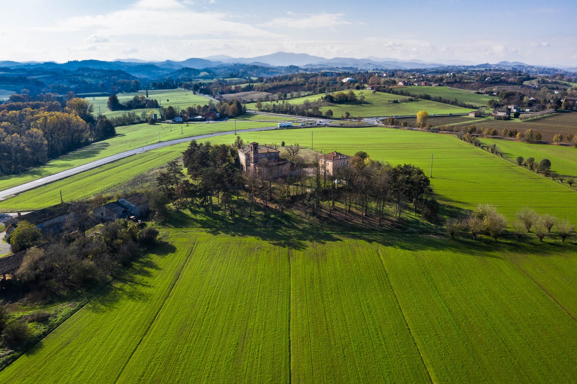
CABRIOLO VILLAGE IS A CRUCIAL STAGE ON THE VIA FRANCIGENA ITINERARY. ITS PARISH CHURCH IS, IN FACT, NAMED AFTER ARCHBISHOP AND MARTYR THOMAS BECKET OF CANTERBURY WHO IS SAID TO HAVE STOPPED IN THIS VERY PLACE ON HIS JOURNEY TO ROME IN 1167. LATER, AROUND THE YEAR 1200, THE KNIGHTS TEMPLAR BUILT A TEMPLAR ‘MANSIO’ ALONGSIDE THE CHURCH TOGETHER WITH A PILGRIM HOSTEL. THE BUILDING WAS LATER BURNT TO THE GROUND AND HAS BEEN REBUILT AND REMODELLED MANY TIMES OVER THE CENTURIES, TESTIFYING TO ITS IMPORTANCE. THE CURRENT BUILDING IS THE RESULT OF 19TH CENTURY EXTENSION WORK ON THE HISTORIC TEMPLAR PILGRIM HOSTEL.
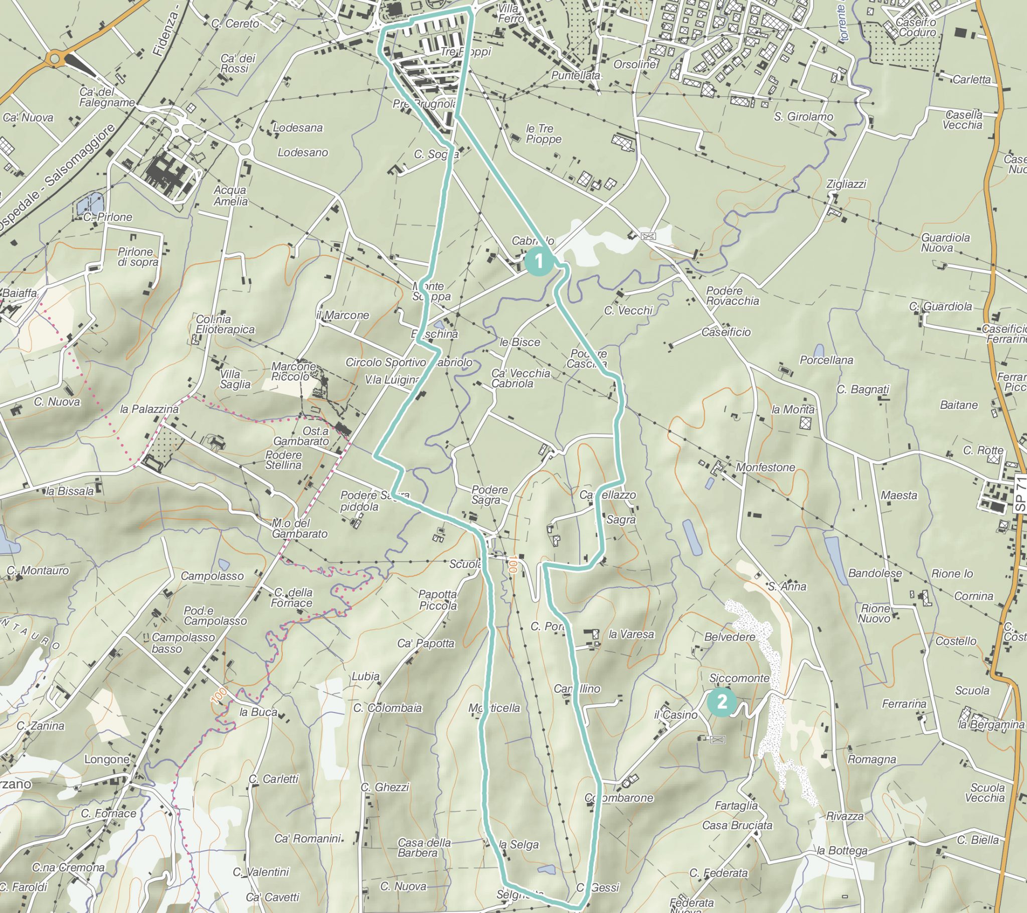
The itinerary you are about to set off on winds through the hills just above Fidenza. The first section follows stage 19 of the Via Francigena step by step, linking Fidenza to the Taro valley. The itinerary which leads to Cabriolo Church starts from the outskirts of the town and is especially attractive. You are travelling along a tarred road which is closed to traffic on this section and known as Viale dei Gelsi after the rows of mulberry trees on either side of it. These trees also testify to the importance that silk farming once had to the local economy, since the silkworms fed on mulberry leaves.
After turning off the tarred road, the route continues along a mule track from which you can admire Cabriolo Church and the smaller mulberry tree avenue, marked at the start by a small wooden chest that holds a book in which pilgrims or walkers passing through can write down their thoughts.
After Cabriolo village, continue in the small valley of Rovacchiello brook, a small tributary of the Rovacchia whose course is marked by the wetland vegetation that runs alongside it. Once you have climbed up the hill, the views open up over the plains and surrounding hills as far as the Appenines and Tabiano Castle. On this section you can catch a glimpse of Siccomonte Church, called so after the brook of the same name. Formally known as ‘della Mola’, this small and characteristic church with its tall, slender 16th century belltower was once a place of passage for pilgrims on their way to Rome. As you walk you may come across a range of small animals from shy roe deer to the more common hares but also foxes, badgers, porcupines and a great many birds. This circular route will take you back through the wetlands of the Rovacchiello, the Siccomonte and the Cogolonghio brooks. In spring you can witness the flowering of many species of impressive and striking woodland flowers, such as snowdrops, snowbells, hepatica and dog’s tooth violets which form colourful carpets in the meadows and among the tree roots in the first mild spring days.
FEATURES
STARTING POINT/FINISHING POINT Ballotta Stadium
LENGTH 10.3 km
ALTITUDE GAIN/LOSS 150 metres
ROAD SURFACE TYPEtarred road and footpaths
DIFFICULTY LEVEL medium
TIME REQUIRED 3 and a half hours
POINTS OF INTEREST
- Cabriolo Parish Church
- Siccomonte Church
DOWNLOAD
You must have an app that opens kml files on your device, in order to view the itinerary on your phone, like for example Google Earth. The GPX files must be installed on the gps using the app given by the provider.

